
Aalst
Re-imagining the river- Scale: Urban and architectural
- Team Representative: architect, urban designer
- Location: Aalst, Flemish Region, Belgium
- Population: 87.000 inhabitants
- Study site: 70 ha
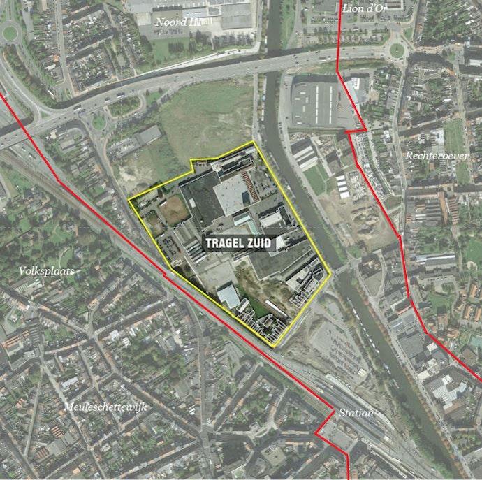
- Project site: 7,5 ha
- Site proposed by: the city of Aalst
- Actors involved: Stad Aalst and her Development Company, NV Matim, Tragel Sport,…
- Owners of the site: the City of Aalst and 2 private organizations
- Commission after competition: Consultant to the city administration, assisting the draft of the future zoning plan
CARE
REINVENTING PRODUCTIVE HERITAGE
Re-imagining the river
Urban City Strategy
Aalst is one of the fasted growing cities in Belgium. The number of inhabitants has increased by 12% since 2005 to 86,000 and is forecasted to grow up to 90,000 future residents 2035. However, Aalst plays a less pronounced role as a regional employer, compared to other central cities in Belgium and Flanders. The number of employed residents is relatively high, however, the overall number of jobs on the territory is the lowest of all central cities, with a job ratio of merely 76%. Aalst is the only central city in Flanders with a larger outbound commute than incoming commuters. We assume that this also causes a brain drain.
Today, space for economy, and more specifically, entrepreneurship is scarce in Aalst. Existing residing companies will be given, every opportunity to facilitate their future expansions. However, the limited surfaces of business parks don’t offer many opportunities for attracting new companies. How can the interweave future additional economical activities with other urban programs in other parts of the city?
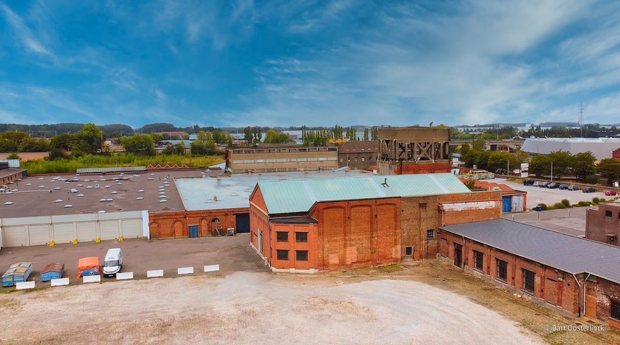
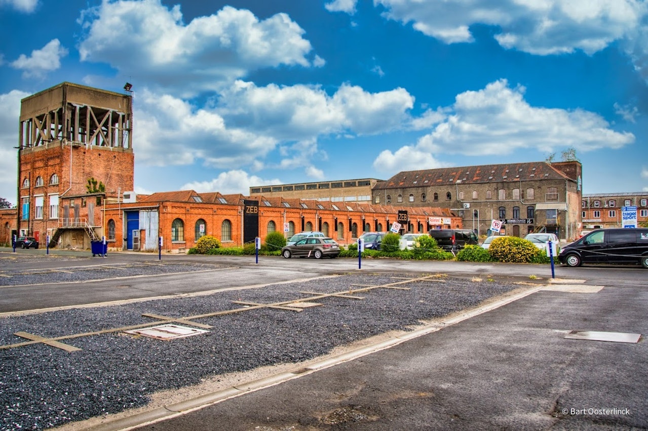
Site definition
The Dender river runs in the middel of the city and collects along its quays a fascinating industrial history and heritage. These quays stretch for of 2.7 km and offer many opportunities for more interwoven economical activities.
Thanks to its large scale, several underused plots, valuable industrial heritage and its strategic location between the Dender, the station and the city center, this district in transition suits perfectly to create a vital urban mix of living, shopping, working, ecology, as well as public functions.
Currently, the city of Aalst participates in a large scale study, launched by the Flemish Government, called “From Vacancy to Interwoven Locations”. In this research, the spatial integration of economical and industrial activities along the Dender quays in the city of Aalst is key and can inspire for sure the participants of this Europan call.

How Must Metabolism and Inclusivity Be Developped and Connected?
The northern part of this strategic zone along the Dender river is selected as the Europan site and is representative of the overal transformation of the former industrial quays in Aalst, but also many other European industrial waterfronts.
From a first exploration on the quays, a great potential for this site specifically was detected to develop a cluster of urban distribution, manufacturing, recycling and creative economics. Given the special potential to interweave economic activities in this project zone, it is essential to give the manufacturing and creative economy a place here, together with the many other urgent space needs: nature, recreation and relaxation, living, public services, education,…
During this legislature, a zoning plan will be drawn up for this site, in order to facilitate the conversion of the industrial zone into a more urban program. However, to do so, there is an urgent need for a spatial framework and creative architectural concepts that can guarantee the harmony of this high-quality urban mix. The winner of the competition will support the city in drafting up this plan and therefore will have a long-term and big impact in transforming a large and central part of the city. Can you imagin here a logistics hub, a circular hot spot, a dispatch center for parcel delivery services, social economy companies such as a recycling center or a bicycle courier? How can people also live here? How could the landmarked buildings be repurposed? How can the banks of the Dender be both a place to stay and a valuable ecological link, but also leave room for the necessary distribution and local flows?